Urban Treble
Fall 2016
School of Planning and Architecture, New Delhi
Critic / Rahoul Singh (RLDA)
Urban Design Studio
Sector 10, Dwarka, New Delhi, India
︎
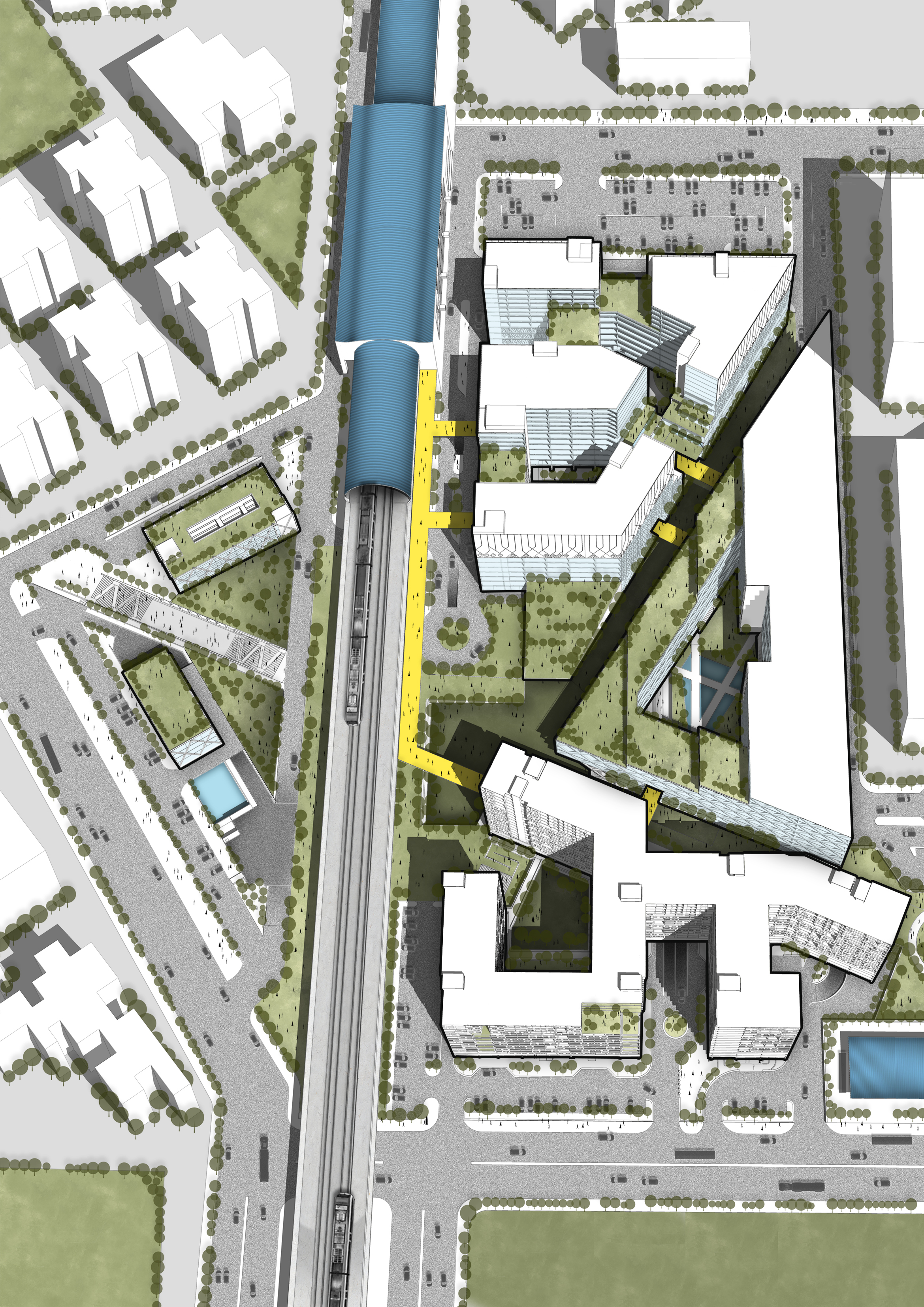 oblique / bird’s eye view of the entire site from the east
People have their teeth sunk in multiple interests and activities. They enjoy speed and high performance. Static is stale, and more is, in fact, more. To serve to a multi-tasking population a multi-use program is developed by tossing all functions in a salad bowl and crafting combinations. The city of Delhi navigates through a complex transit system including bus and metro network, along with roads flooded with private vehicles, auto-rickshaws, cycle rickshaws, and now cabs in the new Uber-Ola era. Intra-city transit mustn’t function independently of the city’s activities and so this multi-use program finds itself plugged to a multi-modal transit point at Sector 10 Dwarka metro station and the national highway.
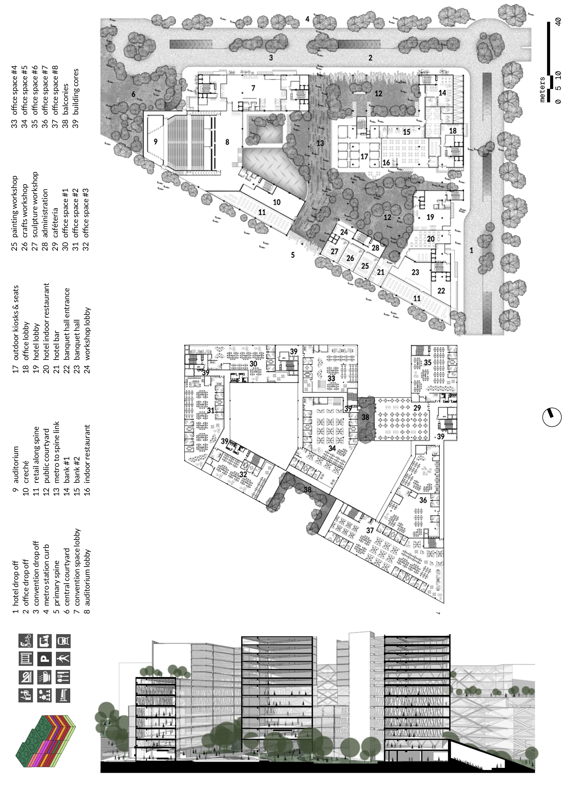
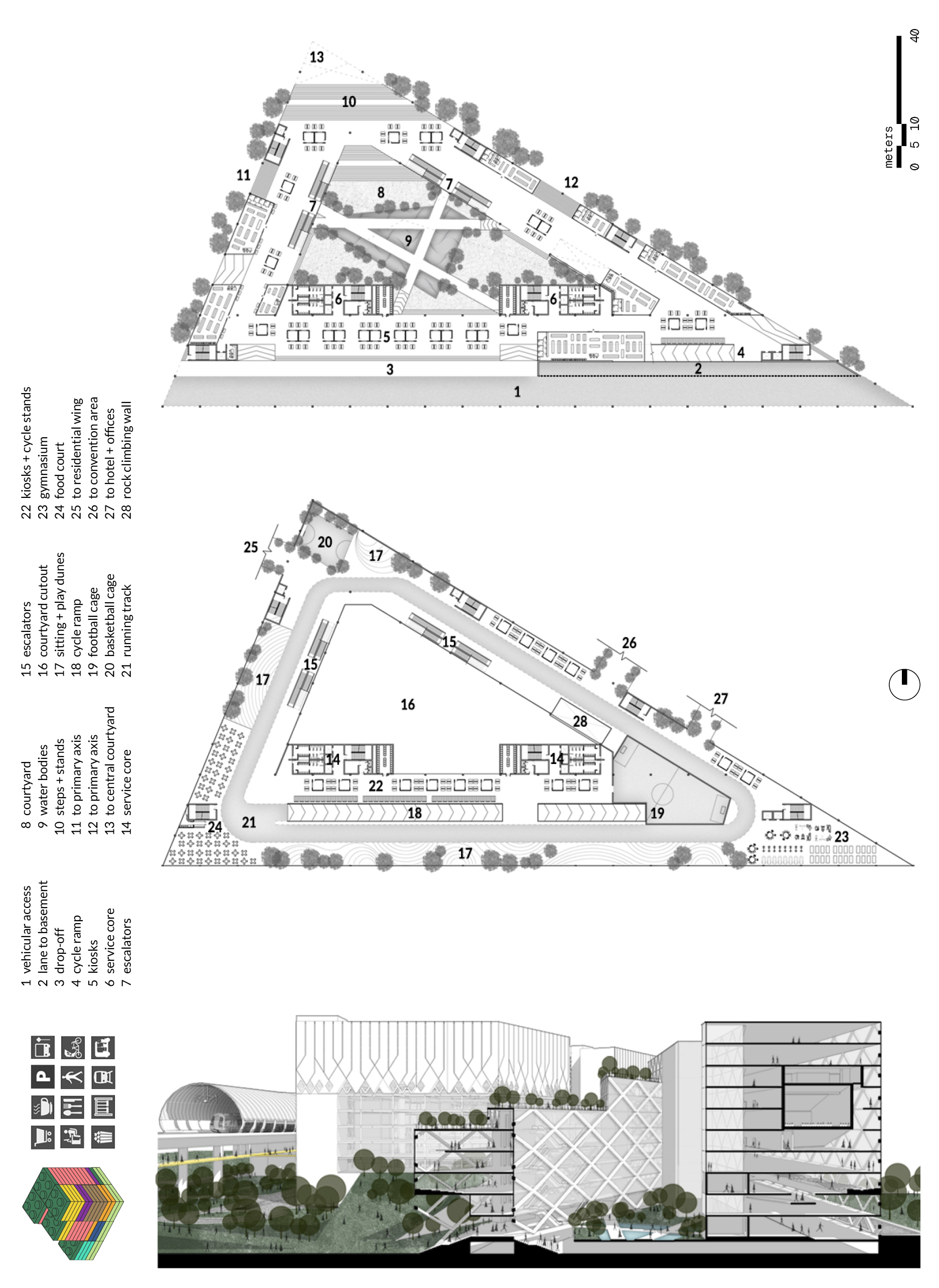
The site is split into quadrants by three pedestrian axes all of which link critical public nodes inside and outside the site (namely, the Blue Line of the Delhi Metro at the Sector 10 station, two bus stops in the North and the Highway on the South, a low-traffic bus depot, rickshaws, and e-rickshaws and all other private and commercial vehicular networks). The program development is not as capricious or arbitrary as it sounds. Each built volume is a combination of workable ingredients. The western flank which is linked with tertiary roads is occupied by residences and supported by f&b, quotidian retail, and recreational assets. The southern flank is a triangular courtyard spooled with retail, offices, entertainment, and f&b, becoming the center around the park and existing commercial buildings. The east block is a podium with individual blocks of corporate offices, workshops, serviced apartments, and a hotel and also supported by retail and f&b assets. The north quadrant is seen as the center for all neighboring residential communities, including the one proposed on-site, and has everyday retail, a sports complex, and a primary school.
The Urban Treble’s focuses on maximizing greens and pedestrianization. Sunken courtyards, green balconies, green roofs, and green knolls are proliferated all over the site and weaved with the built. Cars are restricted to the periphery and functions are aligned to the metro, bus stop, existing informal feeder systems, and urban fabric. A bridge linking public floors on of all buildings to the south of the metro line provides an alternate pedestrian and cycle access from the metro station, and may be accessed by users from outside of the site to walk up and access the metro station, public floors or just enjoy the view.
Finally, the underneath of the metro line, a commonly abandoned and often unsafe zone in the city is reactivated as a long strip that flows eastwards. Consisting of well-lit pedestrian routes, water bodies, sandpits, and playfields, it makes the area safe and potential grounds for commercial and non-commercial temporal activities, another idiosyncrasy of the city.

diagram / development of a mixed land-use salad
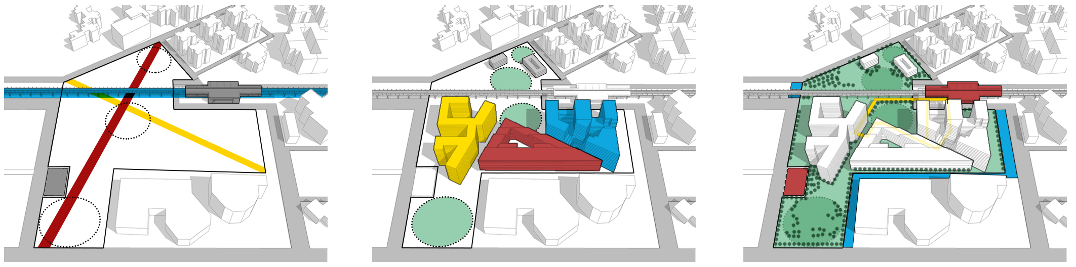
urban axes and nodes
built and nodes
multi-modal intersection
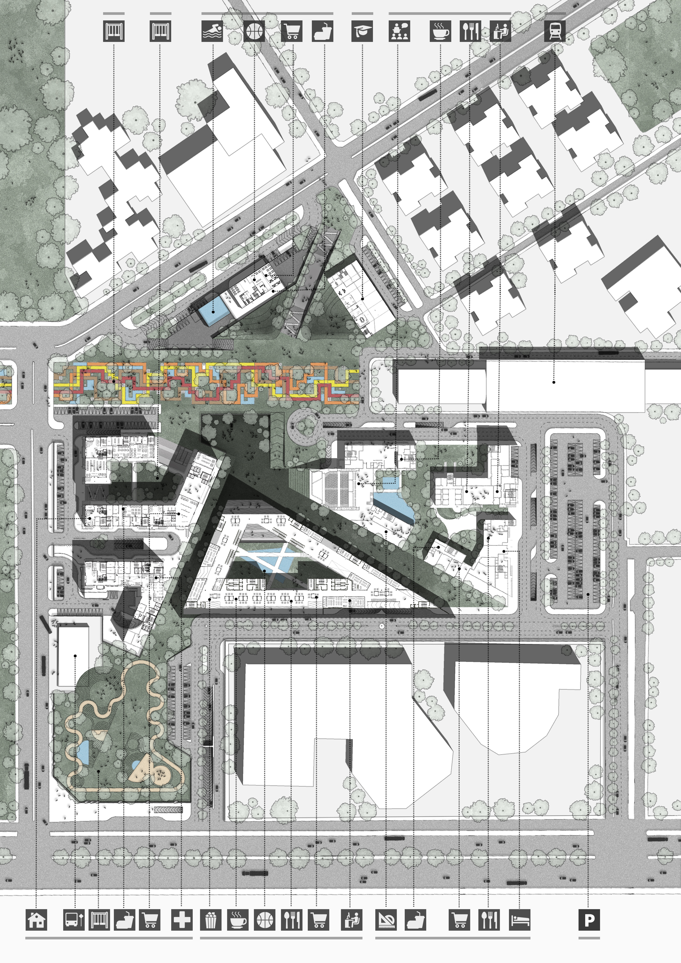
plan / urban layout and mixed use composition
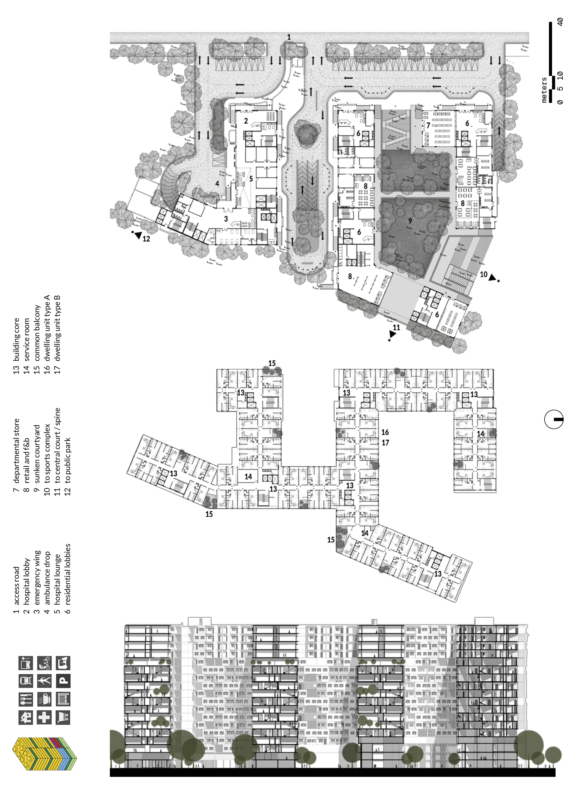
plan, section / east wing, residential + hospital
plan, section / west wing, offices + hotel + convention
plan, section / south wing, retail + recreation + offices
︎